Disaster Management · TEE · papers
Q7A · Discuss in detail application of GIS in Response for Floods Disaster management citin…
2023-02-07 · Semester V/VII re-exam
Actual older TEE paper · 100 marks · Q1 compulsory; any four of Q2–Q7
Q7A. Discuss in detail application of GIS in Response for Floods Disaster management citing at least 5 examples. [10 marks]
Answer
For river flood management, GIS provides a common location-based picture for agencies. Data quality, access, update time and field verification determine its usefulness.
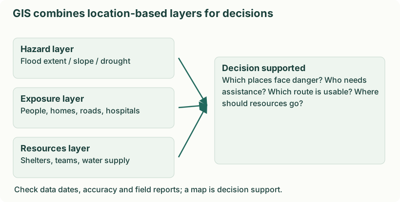
Diagram: GIS combines location-based layers for decisions. Labels: GIS combines location-based layers for decisions | GIS combines location-based layers for decisions | Hazard layer | Flood extent / slope / drought | Exposure layer | People, homes, roads, hospitals | Resources layer | Shelters, teams, water supply | Decision supported | Which places face danger? Who needs | assistance? Which route is usable? Where | should resources go? | Check data dates, accuracy and field reports; a map is decision support.
- Mitigation. Overlay flood extent/depth, terrain and development to support floodplain zoning, storage planning and protection of critical facilities.
- Preparedness. Map forecasts, vulnerable settlements, shelters and alternate evacuation routes; rehearse responses to road and bridge closures.
- Response. Update inundation and accessibility maps, locate stranded people and allocate boats, supplies and medical teams using verified field reports.
- Recovery. Map damage and losses, track restoration of roads and water supply, prioritise rebuilding and check that reconstructed assets are less exposed.
Remote sensing can update affected-area mapping, but weather, resolution, signal availability and processing time may limit observations. Protect sensitive household and health information when sharing maps.
- Extent. Map verified inundation.
- Access. Identify closed and usable routes.
- People. Locate stranded or isolated communities.
- Resources. Map boats, teams, shelters and hospitals.
- Priorities. Match urgent needs to suitable resources and update as conditions change.