Disaster Management · TEE · papers
Q4A · Explain in detail the role of GIS in effective Disaster management for Landslides.
2023-12-04 · Semester V final
Actual older TEE paper · 100 marks · Q1 compulsory; any four of Q2–Q7
Q4A. Explain in detail the role of GIS in effective Disaster management for Landslides. [10 marks]
Answer
For landslide management, GIS provides a common location-based picture for agencies. Data quality, access, update time and field verification determine its usefulness.
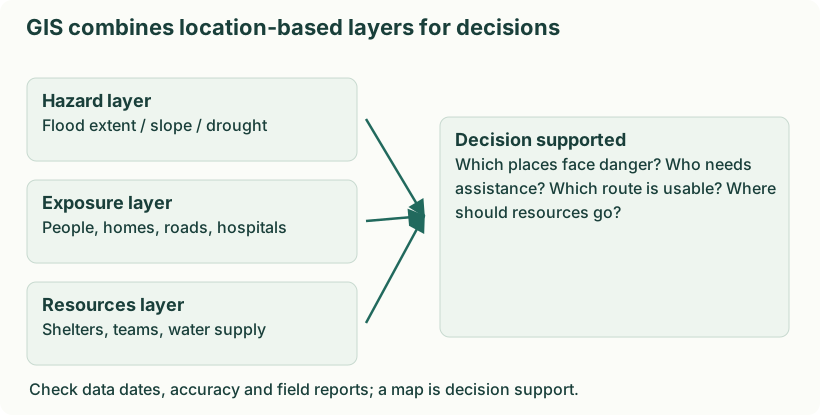
Diagram: GIS combines location-based layers for decisions. Labels: GIS combines location-based layers for decisions | GIS combines location-based layers for decisions | Hazard layer | Flood extent / slope / drought | Exposure layer | People, homes, roads, hospitals | Resources layer | Shelters, teams, water supply | Decision supported | Which places face danger? Who needs | assistance? Which route is usable? Where | should resources go? | Check data dates, accuracy and field reports; a map is decision support.
- Mitigation. Combine slope, geology, drainage, land cover and past failures to map susceptibility and guide development controls.
- Preparedness. Map rainfall thresholds, monitoring points, settlements and safe routes; practise road closures and evacuation.
- Response. Update slide extent and blocked roads; identify isolated communities and safe team access using verified reports.
- Recovery. Assess damaged land and infrastructure, select safer reconstruction sites and monitor slope stabilisation and drainage repairs.
Remote sensing can update affected-area mapping, but weather, resolution, signal availability and processing time may limit observations. Protect sensitive household and health information when sharing maps.