Disaster Management · TEE · papers
Q6A · Explain in detail how GIS can prove to be an efficient tool for Tsunami Disaster Mana…
2026-02-12 · Semester V re-exam
Actual TEE paper · 100 marks · 3 hours · Q1 + any four of Q2–Q7
Q6A. Explain in detail how GIS can prove to be an efficient tool for Tsunami Disaster Management for 4 phases of Disaster Relief [10 marks]
Answer
For tsunami management, GIS provides a common location-based picture for agencies. Data quality, access, update time and field verification determine its usefulness.
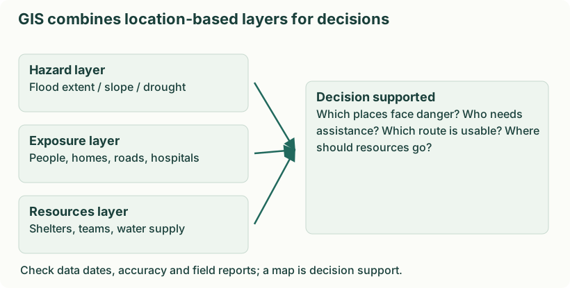
Diagram: GIS combines location-based layers for decisions. Labels: GIS combines location-based layers for decisions | GIS combines location-based layers for decisions | Hazard layer | Flood extent / slope / drought | Exposure layer | People, homes, roads, hospitals | Resources layer | Shelters, teams, water supply | Decision supported | Which places face danger? Who needs | assistance? Which route is usable? Where | should resources go? | Check data dates, accuracy and field reports; a map is decision support.
- Mitigation. Combine coastal elevation, modelled inundation and exposed settlements to guide land use and locate critical facilities outside high-risk areas.
- Preparedness. Map safe high ground, marked routes, travel time, shelters and people needing assistance. Use realistic scenarios in evacuation drills.
- Response. Overlay verified inundation, blocked roads, stranded people and available rescue resources. Use updated information to select safer access and prioritise urgent assistance.
- Recovery. Compare before/after imagery, map damage and service restoration, plan safer reconstruction and monitor whether assistance reaches affected settlements.
Remote sensing can update affected-area mapping, but weather, resolution, signal availability and processing time may limit observations. Protect sensitive household and health information when sharing maps.