Disaster Management · TEE · papers
Q3B · “GIS is an effective tool for River Flood Disaster Management”. Explain the statement…
2025-05-12 · Semester VI final
Actual older TEE paper · 100 marks · Q1 compulsory; any four of Q2–Q7
Q3B. “GIS is an effective tool for River Flood Disaster Management”. Explain the statement in detail. Elaborate in brief how it can be adopted in four Phases of Disaster Relief. [10 marks]
Answer
For river flood management, GIS provides a common location-based picture for agencies. Data quality, access, update time and field verification determine its usefulness.
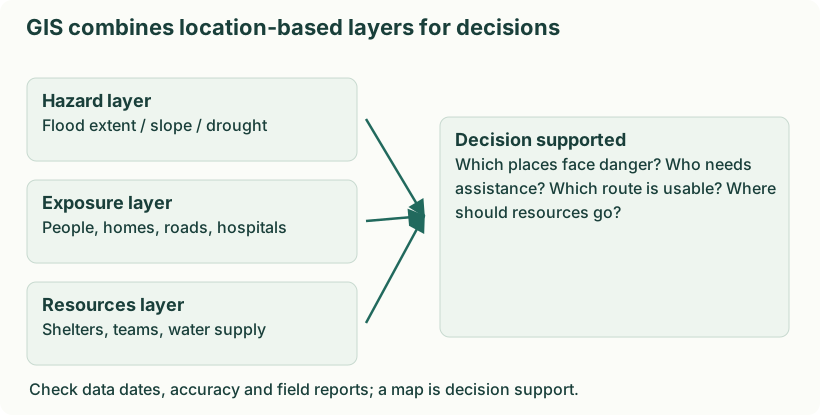
Diagram: GIS combines location-based layers for decisions. Labels: GIS combines location-based layers for decisions | GIS combines location-based layers for decisions | Hazard layer | Flood extent / slope / drought | Exposure layer | People, homes, roads, hospitals | Resources layer | Shelters, teams, water supply | Decision supported | Which places face danger? Who needs | assistance? Which route is usable? Where | should resources go? | Check data dates, accuracy and field reports; a map is decision support.
- Mitigation. Overlay flood extent/depth, terrain and development to support floodplain zoning, storage planning and protection of critical facilities.
- Preparedness. Map forecasts, vulnerable settlements, shelters and alternate evacuation routes; rehearse responses to road and bridge closures.
- Response. Update inundation and accessibility maps, locate stranded people and allocate boats, supplies and medical teams using verified field reports.
- Recovery. Map damage and losses, track restoration of roads and water supply, prioritise rebuilding and check that reconstructed assets are less exposed.
Remote sensing can update affected-area mapping, but weather, resolution, signal availability and processing time may limit observations. Protect sensitive household and health information when sharing maps.